|
tThe NASA Mars Rover Opportunity was finally declared lost this week and the mission officially ended. Across the media, odes to the amazing longevity of the Little Rover That Could have been effusive, which is justified; the robot built to last 90 days managed to keep on chugging along for 15 years, covering 28 km and teaching us an enormous amount about Mars along the way.
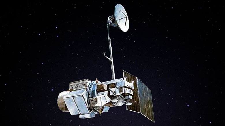
For remote sensors like myself, we're used to NASA building stuff that lasts well past its intended lifetime. NASA has a knack for building things that go into space, the harshest craziest environment imaginable for the sensitive equipment on board, and then keep collecting amazing data long past their expiration date. The Landsat series of orbital sensors is the foundation for the entire global remote sensing program, and has showed us just how amazing it is to be able to see Earth change over time (and our footprint on Earth along with it). Trust me, you've seen Landsat data at some point -- the entire archive is part of Google's extensive mapping collection and the satellite scenes in Google maps were Landsat before they were higher resolution (and are still Landsat in many more remote areas of Earth). Here's how NASA has fared with regards to longevity in the Landsat collection: Landsat 1: Launched in 1972, the Multispectral Scanner (MSS) aboard Landsat 1 was designed to last a year, it collected over 100,000 scenes before the recording device failed in 1978. It also discovered a new island up in Canada that NOBODY KNEW EXISTED. How friggin' cool is that? Landsat 2: Launched in 1975, Landsat 2 was still basically a giant experiment in how much data we could collect. It surpassed the 200,000 scene mark, and was taken out of service in 1982. Designed to last a year, it lasted seven years. Landsat 3: Launched in 1978, made it to 1983. Not as long as its older siblings, but still pretty darn impressive, especially considering they changed the configuration of the sensor on this one to include a thermal band. Landsat 4: The first "TM" sensor, Landsat 4 included SWIR bands and a thermal band. Higher resolution, higher frequency of acquisition....this was a major overhaul in Landsat history. It was designed with a life expectancy of 5 years. It launched in 1982 and its mission ended in 1993. Not too shabby, Landsat 4, not too shabby. Landsat 5: I will admit, I might have cried a small tear when Landsat 5 finally went offline. Launched in 1984, Landsat 5 was sent up earlier than planned, and had only a 3-year life expectancy. It had a few issues over the years, including a few months here and there in the late 2000s when it went offline due to some malfunction or another. But by the time it was finally decommissioned in 2013, a full 29 years after launch, Landsat 5 had collected over 2.5 million scenes, and given us an amazing view of our changing Earth. I miss you, Landsat 5. Landsat 6: Did not achieve orbit. Landsat 7: Launched in 1999, Landsat 7 was the first sensor to include a panchromatic band, thus it is the Enhanced Thematic Mapper (ETM+). It was designed to last 3-5 years. In 2003, the scan-line corrector failed, which resulted in production of scenes that are missing data in lines, giving images a "striped" look. However, Landsat 7 continues to collect valuable data, 20 years running and still going strong. Landsat 8: Launched in 2013. Some of us *might* have had launch parties when Landsat 8 officially achieved orbit and began transmitting data. It was designed for a 5-year mission minimum, carries 10 years of fuel, and will be joined (we hope) by Landsat 9 in 2019. Special shout out to MODIS: I personally mostly use Landsat because of the higher spatial resolution. But I would be remiss not to acknowledge the other major Earth-observing workhorse: the two MODIS sensors, Aqua and Terra. Terra launched in 1999 and Aqua launched in 2002. Both were designed to last 6 years, and are still going strong with no issues. Because they capture the entire Earth daily over a much larger range of the spectrum, the MODIS sensors have fundamentally altered our ability to track changes and observe acute and often catastrophic events, like hurricanes, wildfires, and floods. Most people know NASA for the moon and the shuttles. But NASA builds amazing equipment that collects vital data for a really, really long time -- we love you NASA.
0 Comments
Leave a Reply. |
AuthorCrystal Kolden studies wildfire as a function of human and climatic influences. After starting her career as a wildland firefighter in northern California, she is now a professor of Pyrogeography at the University of Idaho. Archives
February 2019
Categories |

 RSS Feed